
Summit Caldera
Geological Sites
Summit Caldera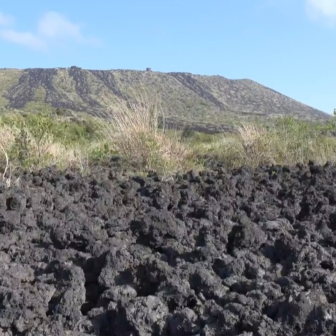
The 1950-51 Lava Field
Geological Sites
Summit Caldera
An’ei Lava Mounds 1777-78
Geological Sites
Summit Caldera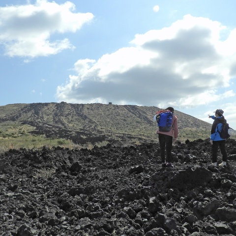
1986 Lava Flows (1986 LA)
Geological Sites
Summit Caldera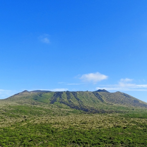
Mt.Mihara (Mihara-yama Central Cone)
Geological Sites
Summit Caldera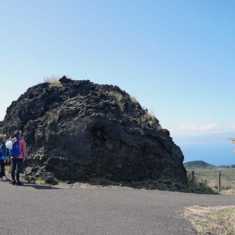
Large Fragments of Agglutinate
Geological Sites
Summit Caldera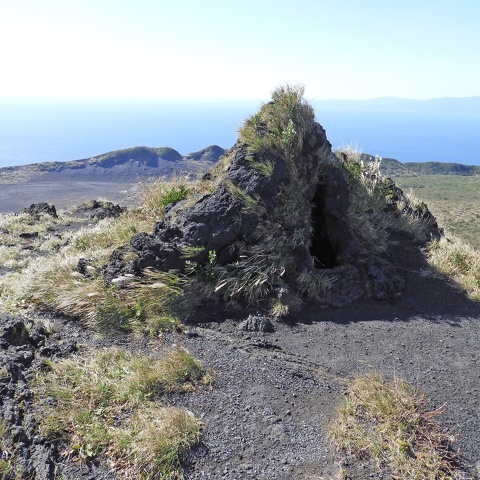
Hornito
Geological Sites
Summit Caldera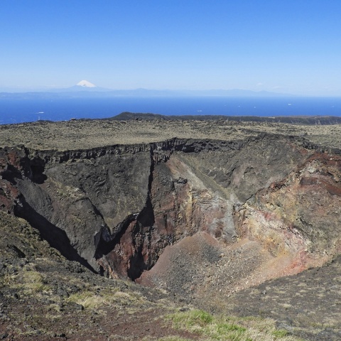
Mt.Miharashinzan / Mt.Mihara Summit Pit Crater
Geological Sites
Summit Caldera
Kengamine Peak
Geological Sites
Summit Caldera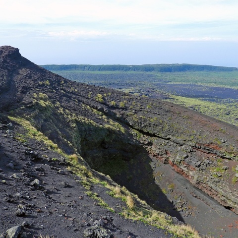
1986 Fissure Eruption B Craters
Geological Sites
Summit Caldera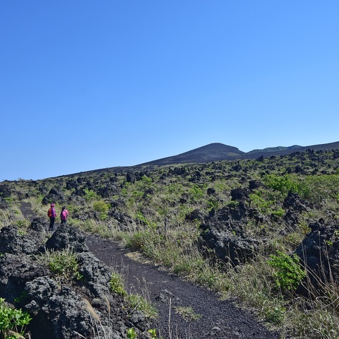
1986B Lava Flow (LB) / Geo Rock Garden
Geological Sites
Summit Caldera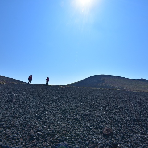
Ura-Sabaku Desert
Geological Sites
Summit Caldera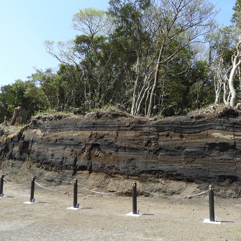
Outcrop at Onsen Hotel Parking Lot
Geological Sites
Summit Caldera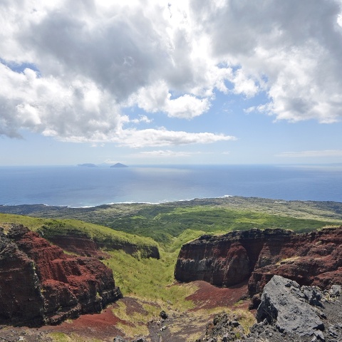
Akadare (Red Valley)
Geological Sites
Summit Caldera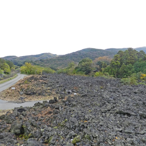
1986 Fissure Eruption C Craters / 1986C Lava Flow (LC)
Geological Sites
Motomachi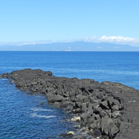
Cape Nagane
Geological Sites
Motomachi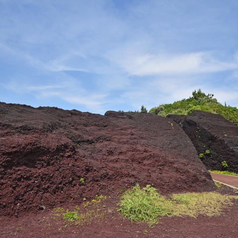
Akappage (Red Hill)
Geological Sites
Kitanoyama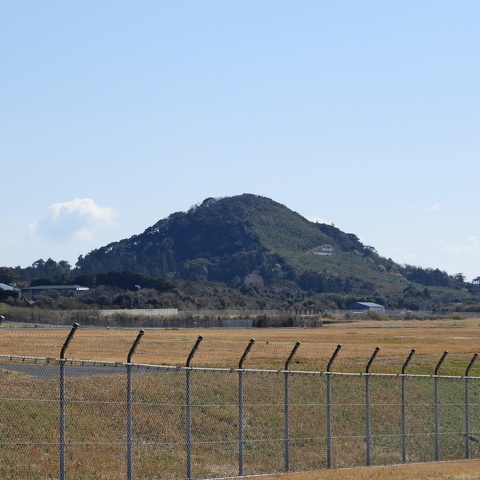
Mt. Atago (Atago-yama Scoria Cone)
Geological Sites
Kitanoyama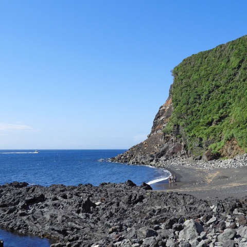
Cape Chigasaki / Nodahama Beach
Geological Sites
Okata
Lava Arched Bridge
Geological Sites
Senzu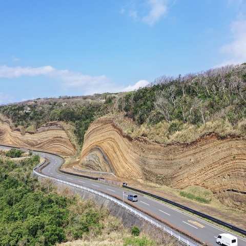
The Great Road Cut
Geological Sites
Nomashi・Mabushi
Sanohama Beach
Geological Sites
Nomashi・Mabushi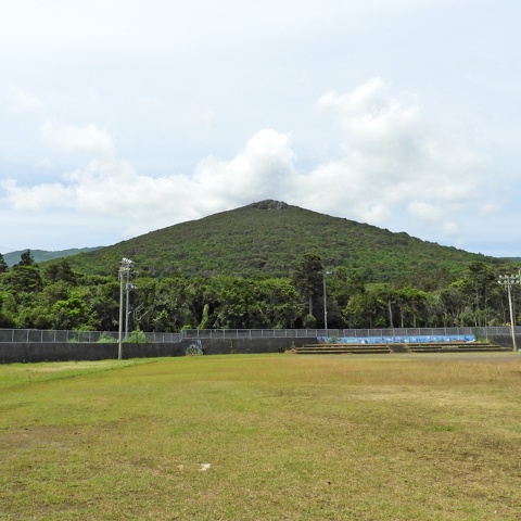
Mt.Takenohira (Takenohira Scoria Cone)
Geological Sites
Sashikiji・Kudacchi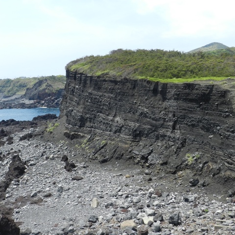
Imasaki Sea Cliff
Geological Sites
Sashikiji・Kudacchi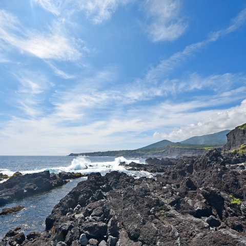
Toshiki Coast
Geological Sites
Sashikiji・Kudacchi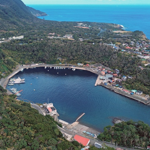
Habu Port (Explosion Crater)
Geological Sites
Habuminato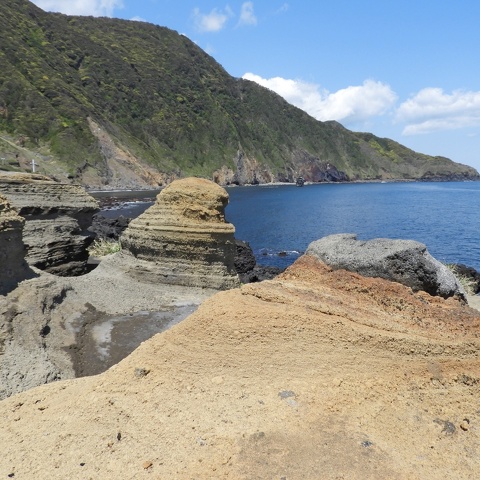
Kakihara Coast
Geological Sites
Habuminato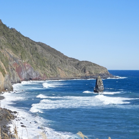
Fudeshima / Fudeshima Coast
Geological Sites
Habuminato